Map text tutorial
Draw a map
Description
If you have some knowledge of the JSON data, you can also use "Import JSON" to draw a variety of charts directly.
The map you draw does not completely restore the true geographic coordinates 100%. Secondly, because many regions have large latitude and longitude data, it will be slower when pasting. Please be patient. Do not repeat the paste
Drawing step
1. Please draw or select an object such as a rectangle or Artboard.
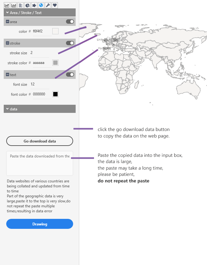
2. Fill in the corresponding color values in the Area/Stroke/Text section, the width of the line to be drawn, etc.
3. In the Data section, select the area you want to draw by using the drop down box.
4. Click the to download the corresponding data button, the pull box assistant will open the corresponding website, the URL has the map latitude and longitude data you want to draw
5. Copy the latitude and longitude data on the website and paste it into the data input box of the pull box assistant
6. ClickDrawingbutton, NB Charts will automatically draw the graphics you need.
Interpretation of various parameters